
General considerations
Distinct urban districts, be it historically, socially, culturally and/or economically, which have been conceived and planned as bona fide municipalities or as proto “new towns in town,” have developed architectural signature and planning layouts which help make clear the limit between them and their surroundings.
The corollary of this is the high probability of perceivable entry points along these limits where crossed by dedicated means of access.
These dedicated means of access invariably connect these entry points to recognizable epicentres that could be a particular open space, or group of buildings, or monuments, or most often a commercial magnet strip.
Crossing into such districts and entering their epicentres one may feel like having arrived in a distinct “there”… this experience will be at the heart of my observations and analysis, i.e. how cohesive, articulated and/or nuanced is the “there” and how does one perceive its environmental structure?
One lead, as mentioned in my last post, is that the “there” is not so much the result of a determining physical landscape as it is the physical expression of a determining social landscape. The case presented illustrate this condition quite clearly.
Context
Around the time of the First World War, with highways still a ways off and with the train still the main transportation mean for people and goods in medium and long hauls, the owners of the Canadian Northern Railways invested in a tract of land south of Mt Royal, to serve as the downtown terminal, and in one north of Mt Royal, to be planned as a model city, which would accommodate the suburban railroad extension and its first stations.
The tract of about 3 square miles used the existing farmland platting overlaid with two diagonal feeder circulation axes crossing at the central transport hub and train station. A few crescents and circles were also overlaid to slow down traffic and make it safe for pedestrians. See map below.

The questions
Given the “planned” nature of this urban development how are its limits and entry points located and physically treated and how is its epicenter located, treated and linked to the project circulation patterns?
The case of Town of Mount Royal (TMR)
Entry point determining agents
Having decided on the geometry of circulation pattern, the planners and developers had to settle the matter of land use zoning in terms of inside and outside user origins.
A delicate matter that was settled by placing commercial and light industrial occupancy at three of the four corners of the plan, i.e. at three of the four “ends” of the crossing boulevards, being therefore accessible to insider users and to outsider users, without the latter adding to internal traffic.
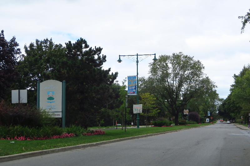
This left one last corner for the ceremonial access to the town, leading to its formal epicentre near which the civic, religious, educational and recreational activities were gathered.
It is at that corner that the formal entry point was located with a “Welcome to TMR” panel. See image below.
Note: a similar panel is informally installed at another strategic corner of TMR. With no physical entrance nearby; it simply signals the crossing into TMR territory. See feature sketch.
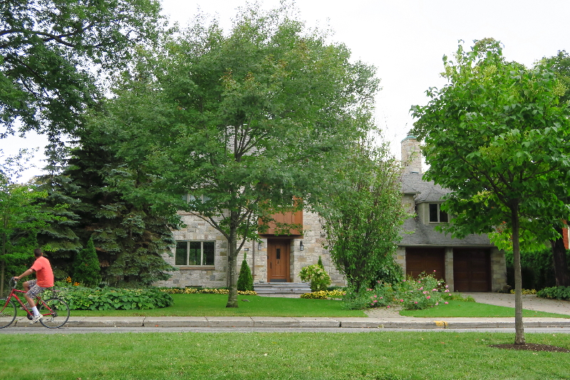
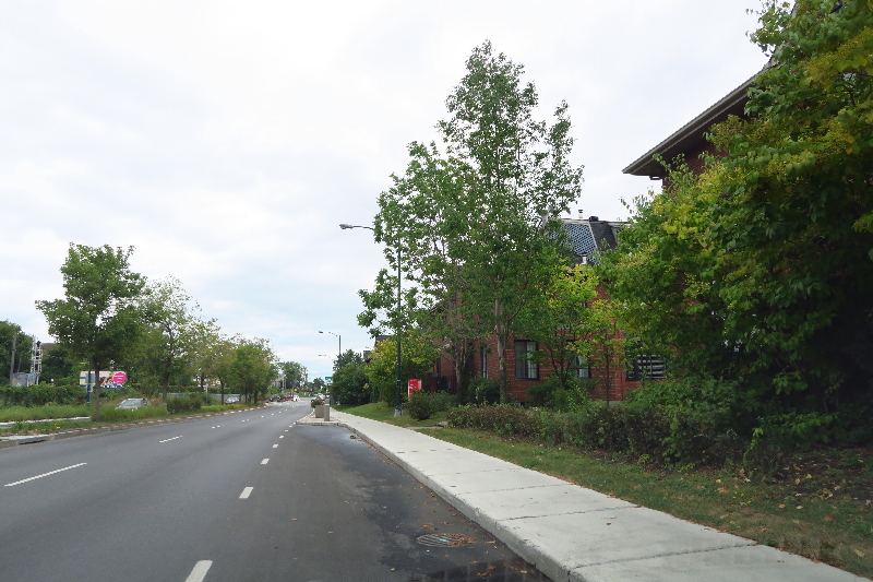
It is along that first leg of the dedicated access boulevard that are located most of the large, more elaborated residences for image-social standing setting. See image below.
Limits treatment determining agents
It is around the center of town that were located the train station and internal serving bus lines stations, while on the peripheral arteries run the external serving bus lines.
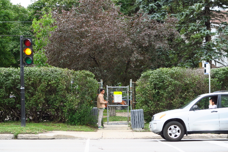
It is along one of these peripheral arteries that is to be found the most clearly defined limit of town as a hedge-camouflaged fence punctuated with a few Frost doors carrying signs prescribing entrance limitations, i.e. residents and visitors but no through traffic. See image below.
The other three limits have been handled through architectural typologies:
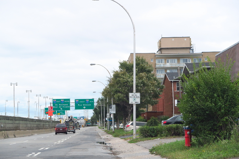
The limit fronting an elevated highway was lined with large scale apartment buildings providing a sound and visual buffer for the rest of the town. See image below.
The limit fronting a main east-west artery parallel to train tracks was treated as a show window with a mix of single family residences and denser row housing, occupying what used to be the only light industry site after it was shut down. See image below.
The last limit simply petered out into adjacent similar single family residential development, where street signs and change in street alignment were the only features suggesting a limit.
Epicentre determining agents
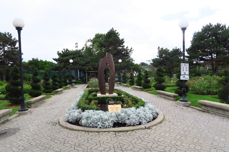
Borrowing from L’Enfant’s plan for Washington DC, the planners of TMR have introduced a certain monumentality in the diagonal boulevards crossing at the railroad station. Let us say rather, a certain “expectation of monumentality” belied by what we find at the “geometric epicentre” of TMR: A train station turned into a pizza joint, albeit very pleasant, a transportation hub turn-around, a social class conscious lawn bowling club and tennis courts, and a soulful rose garden and theme sculpture titled “man and his community.” See image below.
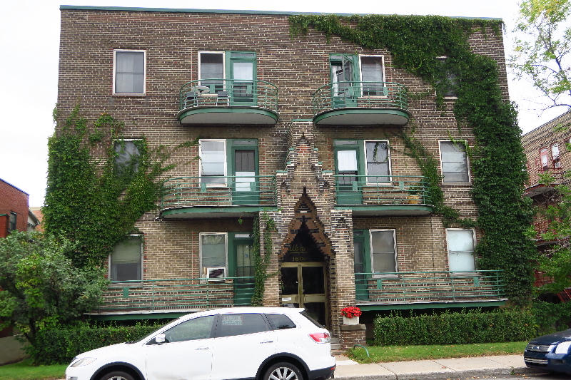
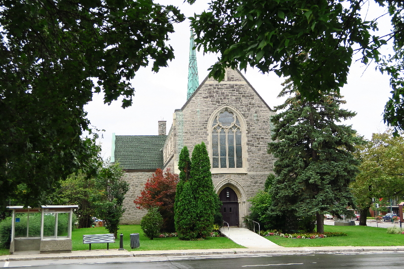
Note (1): the general area immediately near the turn-around harbors some fine examples of brick and stone craftsmanship applied to well scaled apartment buildings, some with commercial venues at ground floor, and a church. See images below.
Note (2): If we enlarge the epicenter radius we find not only the public library, the educational, the administrative and recreational complex of TMR where the citizenry gathers for indoor and outdoor civic events, but also a grouping of medium density apartment and condominium buildings and more commercial venues bringing “life” to this otherwise socially staid formal epicenter.
The geometric epicentre therefore is clearly used to project a status image of social exclusivity, to be viewed by all but used by the few while the recreational, educational and civic institutions of the area around it, not visible from the dedicated access boulevard, and made to serve the residents primarily.
Discussion
TMR ‘s “There,” in terms discussed above, become coloured with a deep sense of “them,” i.e. “there” being sensed as “their” world.
That is what I mean by “social landscape,” yet, sensing the limit, finding the entry point and visiting the epicentre of a spatially expressed social reality called a Town is not necessarily a matter of inclusion vs. exclusion but also one of accommodating civility.
To wit: looking at the feature image you can see beyond the “Welcoming” panel, another smaller one informing one and all of the proper driving and parking behaviour that are accepted in TMR … saying something like “you are welcome, but…”
To wit: the panels that are placed all over TMR announcing this or that event as information for the residents and as subtle invitation extended to the visitors to attend.
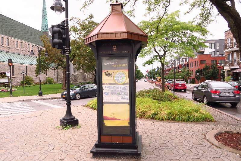
To wit: not far from the turn around formal epicentre we find a “you are here” indicator panel to orient the visitor: a subtle mix of civic pride in its kiosk form, and of sociable neighbourliness in its content. See image below.
End note: the subtle dialogue between the chic diagonal cross axes, as formal cross traffic through TMR, and the labyrinthine layout of neighborhood streets between the diagonal boulevards provides TMR residents with the assurance of little cross traffic in their triangular neighborhoods, turning them into islands of privacy and select exclusive use. See plan of projected TMR in the Context section of this post.
That was, after all, the founding social landscape feature of TMR that remains intact on the whole, projecting at the scale of the town the sacrosanct social spatial structure of the detached single-family house with its well-delimited site, its formal entry and its articulated public vs. private areas.
Sketch and photos credit Maurice Amiel
Plan drawing credit Wikipedia